


#1
The Federal Emergency Management Agency has released an updated map which shows changes in which Roanoke County neighborhoods are impacted by flooding. WFIR’s Denise Allen Membreno has more.
FEMA has released a mapping application featuring new, preliminary flood maps for Roanoke, Roanoke County and Salem. Nickie Mills, the flood plain administrator for Roanoke County; encourages all county residents to review the updated maps to identify any changes affecting their property. Mills says the previous maps were drawn in 2007.
“There’s been a good bit of land development then,” said Mills. “There’s a couple decades of rainfall data that we didn’t have the last time the maps were updated. So those are probably the biggest drivers.”
Mills recommends knowing your risk and talking with your insurer to find out exactly what your policy covers. The county is hosting two informational meetings. The first meeting is Thursday 5 to 7 pm at the Roanoke County Administration Center. Find a link to more information on WFIR News.com
===#2
There is a new map created by the Federal Emergency Management Agency showing some new areas in our region that could be impacted by flooding. As WFIR’s Denise Allen Membreno reports some homeowners that may not have previously needed flood insurance may now be required to buy it.
Homeowners in newly expanded flood hazard areas may now be required to purchase flood insurance if they have federally backed mortgages. Nickie Mills, the flood plain administrator for Roanoke County, says even if your mortgage isn’t federally backed you should know your risk because most homeowner policies do not cover flood damage unless you have purchased flood insurance.
“For most people, it’s minor changes,” said Mills. “Now, there are some places farther upstream. FEMA’s new maps go farther upstream. So there are definitely some people who are new to FEMA’s mapped floodplain. Those areas are where you probably see more people mapped into the new floodplain. And if the house shows up on those maps, you’re probably going to need flood insurance.”
In other areas, FEMA has determined that flood risk has decreased, which may reduce the need for flood insurance. Find a link to the new map at WFIRNews.com or you can attend one of the two county information meetings. The first meeting is Thursday 5 to 7 pm at the Roanoke County Administration Center. Denise Allen Membreno WFIR News.
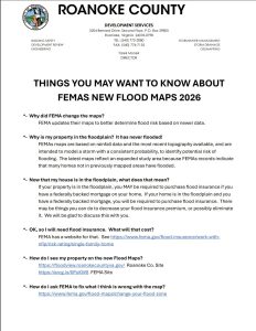
Links from brochure:
*- OK, so I will need flood insurance. What will that cost?
FEMA has a website for that. See https://www.fema.gov/flood-insurance/work-withnfip/risk-rating/single-family-home
*- How do I see my property on the new Flood Maps?
https://floodview.roanokecountyva.gov/ Roanoke Co. Site
https://arcg.is/0PuKW8 FEMA Site
*- How do I ask FEMA to fix what I think is wrong with the map?
https://www.fema.gov/flood-maps/change-your-flood-zone
To view the maps, visit the FEMA Region 3 Flood Map Changes
Roanoke County Information Meetings
February 26, 2026
5:00 p.m. – 7:00 p.m.
Roanoke County Administration Center
5204 Bernard Drive, 3rd Floor Training Room
Roanoke, VA 24018
March 3, 2026
5:00 p.m. – 7:00 p.m.
Glenvar Library
3917 Daugherty Road
Salem, VA 24153
The post New FEMA map may change your need for flood insurance first appeared on News/Talk 960-AM & FM-107.3 WFIR.

